Race info: Trail Racing Over Texas hosts the Brazos Bend 50 every April at Brazos Bend State Park in Needville, TX. The website has plenty of details about the race and course.
In 2015, the cutoff was at least 12 hours with the concurrent 50 miler. Now they have a 16 hour limit and offer a 100k as the longest event.
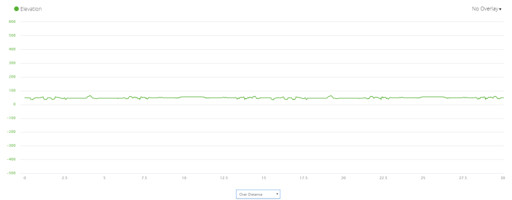
The course is on trail, mostly double track and all of it runnable. Elevation gain for BOTH of the 15.5 mile loops was 127′ according to Garmin.
The closest hotels on the central Texas side of the race are in Rosenberg about a half hour drive from the start; drive time is impacted by congestion getting into the park. This is a very large event and the lines at the gate were long. Parking was fine but TROT has a UHaul van to take people the quarter mile from the farther parking lots to the start/finish area. Flush toilets (x3!) available at the start and at the first aid station.

Race report: The trails were already damp from rain in the week leading up to the race. This meant a course reroute. The added turnaround was a little short, so most people had about 30 miles according to GPS watches. In 2015, a strong storm hit within the first hour of starting the race. It was a short but intense storm with a couple of minutes of hail.

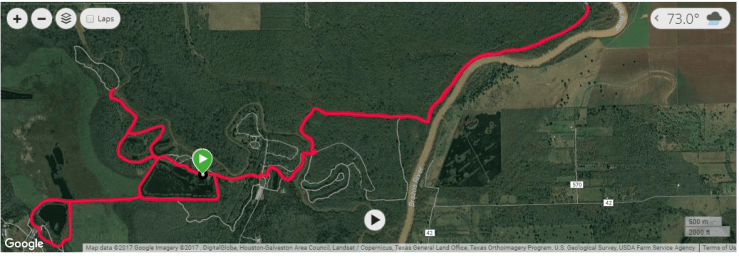
The course starts at the pavilion on a wide gravel path, takes a right around New Horseshoe Lake (with gators) and eventually becomes a dirt path (Big Creek Loop) that can become slimy mud with rain. After a short out and back, it was back to Old Horseshoe Lake and then Elm Lake on a gravel and sometimes broken asphalt path under tall, mossy oaks. The photographer seems to hang out here often for their races. After Elm Lake is a right turn to the Spillway Trail, another lollipop section that’s between two marshy areas on wide trail of small rocks/gravel. Once you hit 40 Acre Lake on the left (more gators), there’s a tiny little incline and a left towards the aid station on dirt trail. After the aid station, there’s another wooded section before coming back out to the lake on the wide gravel trail to finish the loop part of the lollipop. Take a right at the tower to go back on Spillway Trail between the marshes, then a slight right on Elm Lake Loop to head back around towards the start/finish area and energetic spectators. Take a sharp right at the road. The worst of the gravelly sections is here, right next to the road towards the bigger parking area and the windmill. Turn left and run across the road for a short section on pavement and then asphalt as part of the Creekfield Lake ADA Trail. This will take you to the back section of the loop. Cross a meadow and head into a wooded section on dirt trail. Depending on the race and the year, there’s a right turn to the loop around Hale Lake and then the road crossing. Big Creek Bridge Trail, after the second road crossing is wide, flat, and pea gravel. Bluestem Trail and River View Trail are more of the same. For the 2015 race, it was an out and back all the way to the Sawmill Aid Station as shown in the map above (and below).
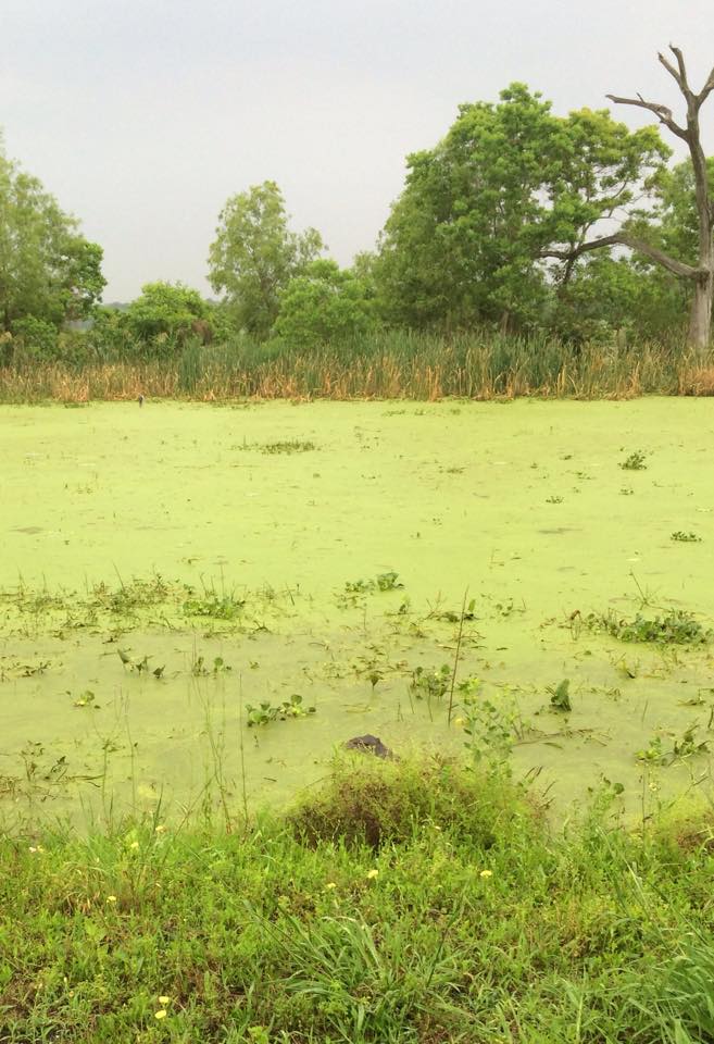
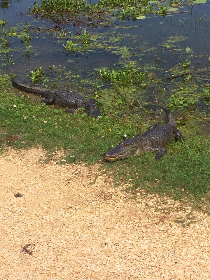
By the second loop, the sun had emerged and it was a warm, humid day on muddy trails. Gators were sunning themselves along the lake banks for most of the first half of the loop. They seemed uninterested in runners but were photogenic. TROT has plenty of food and drinks at the finish. The multiple race distances meant a nice crowd at the finish line even for the slower runners. It’s a good way to try an ultra.

Off trail:
Leave plenty of time to get the the start.
The bathroom at the bigger parking lot near the windmill is open at 5am too and has less of a line.
Don’t bother with the shuttle.
The start/finish area is a good place to store your drop bags and there are spectators around all day.
You would not think the park needs that many signs warning people not to bring their small dogs to a gator-filled lake, but they do.
If your athletic supporter decides to go fill up the car when you have 10 miles or so to go, your AS will probably not be back in time to watch you finish.
