After Rocky, I was not able to run at all for a couple of months. Although I was happy when I could start slowly jogging, it was disappointing to cross off planned races in April, May, June… By June I was able to start training consistently and figured if I found a race with a really generous time limit, I might be able to add another state in 2018. There were not a lot of August options but one was in Montana. I had long ago decided on the Trail Rail Run from Mullan, ID to St. Regis, MT for Montana, described as having gentle grades, beautiful scenery, and moderate temperatures. But this August race looked compelling: 15 hour time limit! Sure there was also 7,875′ of gain and the highest point on the course was about 8,000′. I could train all summer and be able to do 29 minute miles, right?
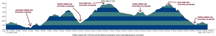
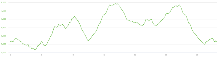
The Helena Ultra Runners League (HURL) hosts the Elkhorn Endurance Runs every August. Options include 50 miles, 50k, and 15 miles. The races are in the Elkhorn Mountains in the Helena National Forest, about 45 minutes south of Helena, MT. The website described the course as remote and beautiful. Specifically, it says, “This run is primarily through unforgiving, remote, and spectacular Montana back country. Experience real Montana…Leave Civilization Behind.” That’s pretty persuasive! One concern was that there are four aid stations (two you will see twice so effectively six on the course) but only two are accessible to crew. One was at the 4 mile point but required almost a mile hike for crew. The second was at miles 12 and 30 (did I mention it’s actually a 52k?) and is a 2 mile hike for crew. The notes for spectator access at the other two aid stations are “not recommended.” If you have read any of the other entries, you know my crew/fiancé likes to go to all of the aid stations but he decided he could have just as much fun by hiking in and volunteering at Teepee Creek all day, where I would see him at mile 12ish and again at mile 31ish, then we could hike the 2 miles to the finish together. The website also includes an extremely detailed description of the course, complete with pictures of intersections, pictures of markings, and the course map:
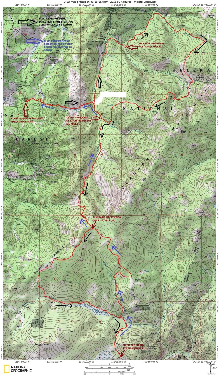
We spent many hours reviewing the course map, National Forest Maps, and what we could find on Strava. When we weren’t studying the maps, I was running hills in the south Texas heat.

August finally arrived and we flew to Salt Lake City so we could take a couple of days to visit places my awesome fiancé has lived in Utah and Idaho. After a long wait and minor misunderstanding at the rental car agency, we eventually hit the road in a Toyota 4Runner that ended up being the ideal vehicle for this adventure.
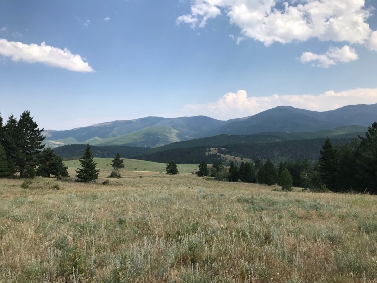
We arrived in Montana the day before the race and, as usual, set out to find the start and see if we could find our way to the Jackson Creek aid station, 4 miles into the race. I had plotted out my worst pace scenario by looking at elevation per mile but it’s always hard to estimate without knowing how technical the trail is. With the extraordinarily detailed directions to the start and the Gaia app on a phone, we were able to find the start line. While we saw plenty of cars the next morning, the road was rough enough in places that we took advantage of the 4WD and wondered if the rental agreement covered off road travel. The view from the start line was amazing:
We backtracked from the start to the forest road, and slowly found our way over to Casey Meadow road that would take us near the Johnson Creek aid station. At the trailhead for Trail 343 that I would turn right on the next day at about mile 4, several people were loading up their horses for what looked like a multiple day trip. They were friendly and when we explained we were here for a race in the forest the next day, they laughed and showed us their packs full of oreos, chips, gummy bears, and delicious COKE. These were the volunteers – the aid stations are so remote that the best way to bring supplies out is by horse! I was impressed and intimidated. I do not think any of the previous races I’ve finished brought in supplies by horse or camped at the aid stations for multiple days.
After checking out what we could see of the trail, we made our way over more forest roads, dirt roads, and back roads to the packet pickup, race briefing, and pasta dinner. We met Steve, the RD, and a few other runners, reviewed the huge map one more time, and were briefed on the highlights of the race and the course. Recent bear activity was shared and we found this very concerning. By now, you may have caught on that I am apparently from the big city and things like “wild” and “remote” are either abstract concepts or just relative ideas – Bandera was remote, right? So I knew that, yes, there are bears in the woods and I had seen many on trips to Yellowstone, Denali, and Exit Glacier. But the idea of being DFL on this course and coming across a bear was…concerning. We skipped the pasta dinner, headed to the hotel in Helena, and asked the front desk clerk where we could get 1) good local pizza and 2) bear spray. We stopped at Bullman’s to place his order and then went to a nearby outdoor store where we discovered bear spray comes in large canisters that would not easily fit in my vest. The sales guy helped us pick a pepper spray instead and assured us we would be fine. Sounded reasonable to me, so we picked up the pizza (very tasty!) and went back to the hotel to read up on bear safety and review the course just one more time.
If you are wondering why I was so obsessed with studying the course map, it’s because the course description included things like, “At approximately 8 miles, the trail enters a meadow and the trail disappears. Watch for rock cairns and course markers as the trail takes a sharp turn to the left and starts dropping gradually into Casey Meadows. There are numerous cow and game trails through Casey Meadows, so pay close attention to course markers.” The one that kept me up at night was this one, “You must encounter two Forest Service Trail Signs in Casey Meadows, and must cross two creeks. Turn left and start uphill at the second sign which is just beyond the second creek crossing.” I will date myself by saying this, but it brought to mind these lines from a computer game I played as a kid, “You are in a clearing, with a forest surrounding you on the west and south. There is a pile of leaves on the ground.”
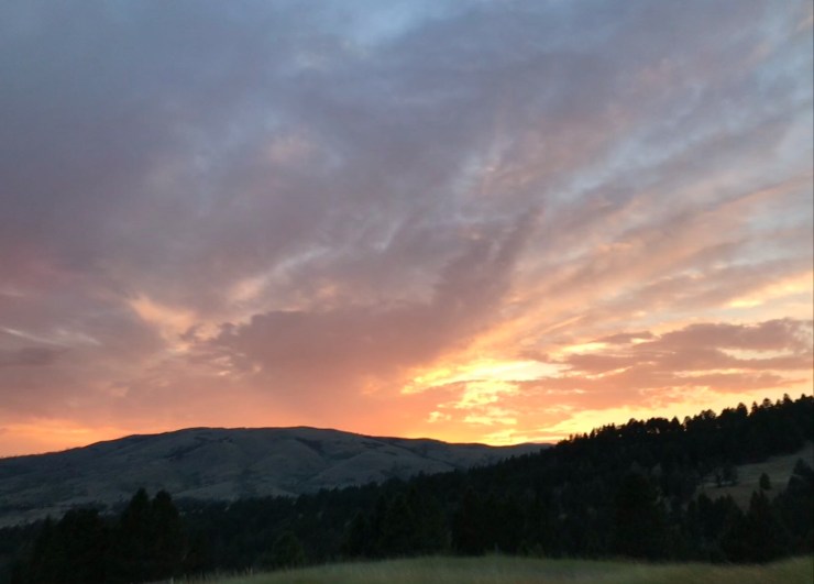
The 52k starts at 7am, 2 hours after the 50 milers have started. The 15 mile race starts an hour later at 8am. As instructed by the race website, we left Helena in plenty of time to make it to the start line by 6:30am. We were able to park close to the start line – the area is not huge but there’s plenty of room. In 2018, about 30 people started the 50 mile, 50 started the 52k, and 75 started the 15 mile. We had time for using the portapotties and taking pictures of the sunrise.
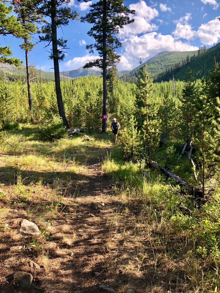
Race report: After some reminders about the course, the RD counted down and we were off. As promised in the description, the course was wide enough after the first quarter mile for people to pass and we started sorting ourselves out.

I was quickly at the back of the pack where I preferred to be. We were heading uphill before the first mile was done and I was doubting myself. Then the second mile was downhill and we crossed the creek (goodbye dry feet) and turned left onto the next trail. By then I was 10 minutes ahead of pace and able to calm down and enjoy the scenery. Mile 3 was along the creek that we’d crossed and the trail was nice packed dirt, not technical. I was really enjoying the trail when I heard awful animal noises – an angry bear? No, just these guys.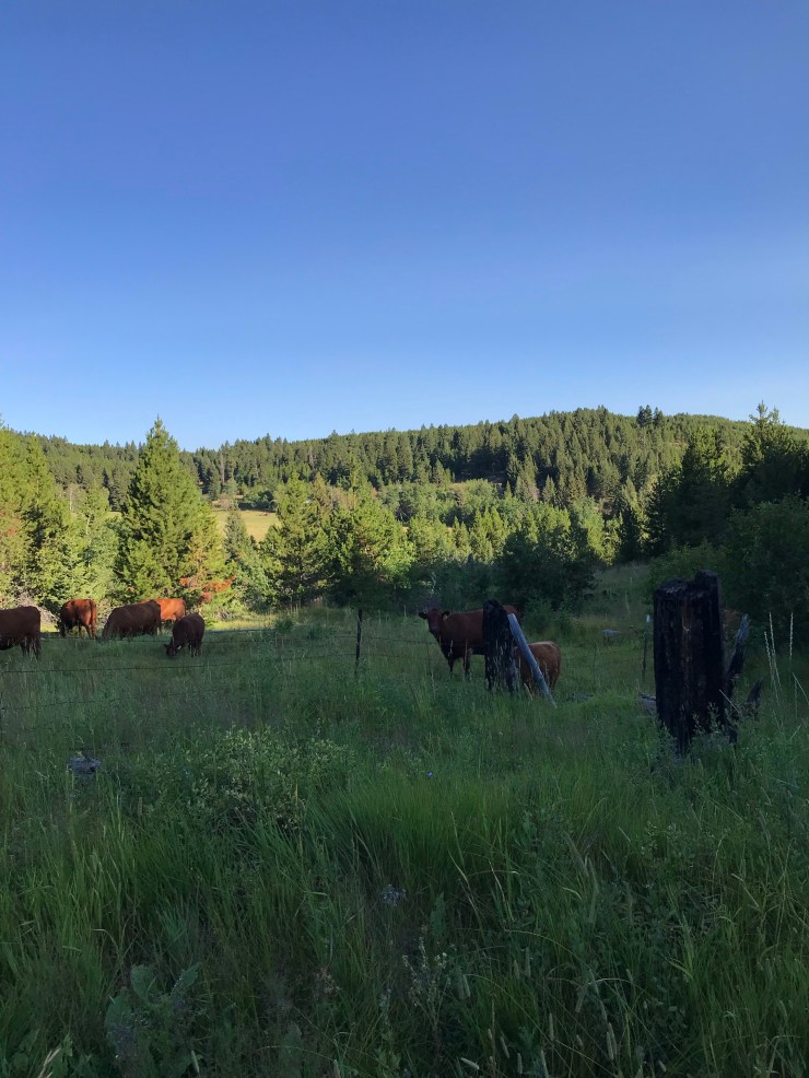
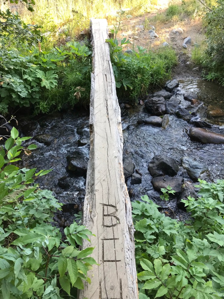
I reached the right turn for trail 343 that we’d found the day before. The uphill was a little more serious now but the creek crossings were a nice distraction.
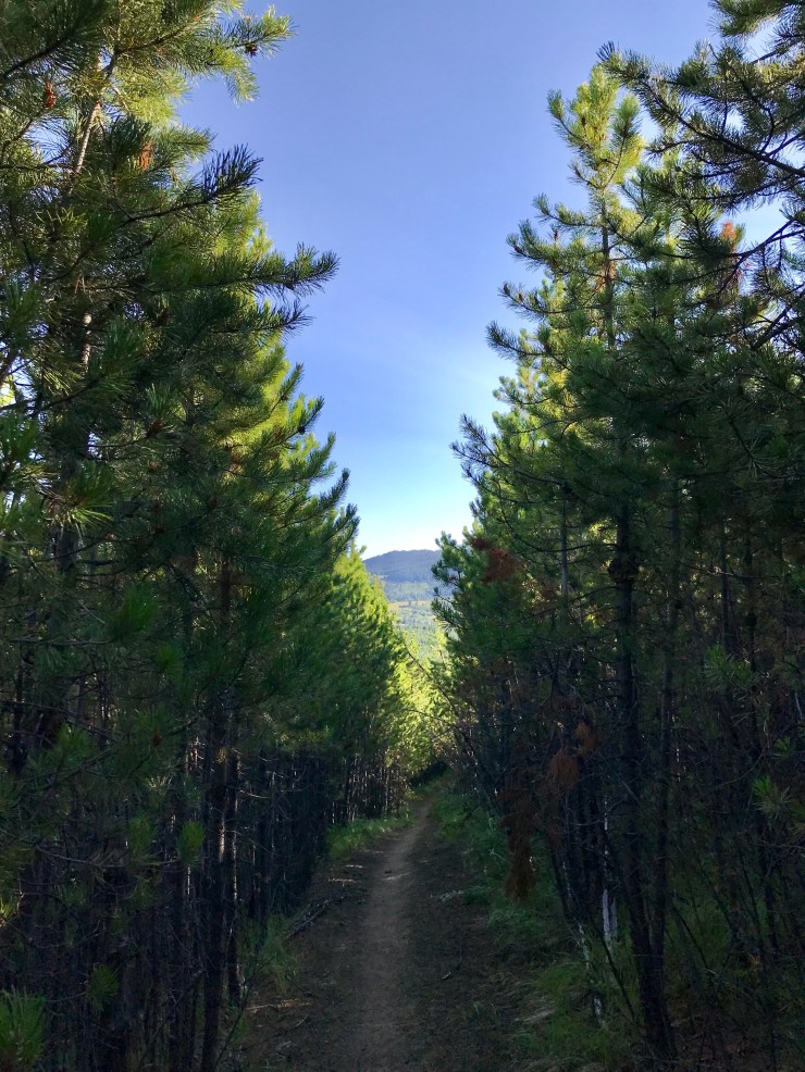
Aid was just past mile 4 as promised and staffed by several boy scouts and dads. They wished me luck on the upcoming climb and made sure I had what I needed for the next 8 miles. I climbed the hill out of the AS and was rewarded with a tunnel of pine trees.
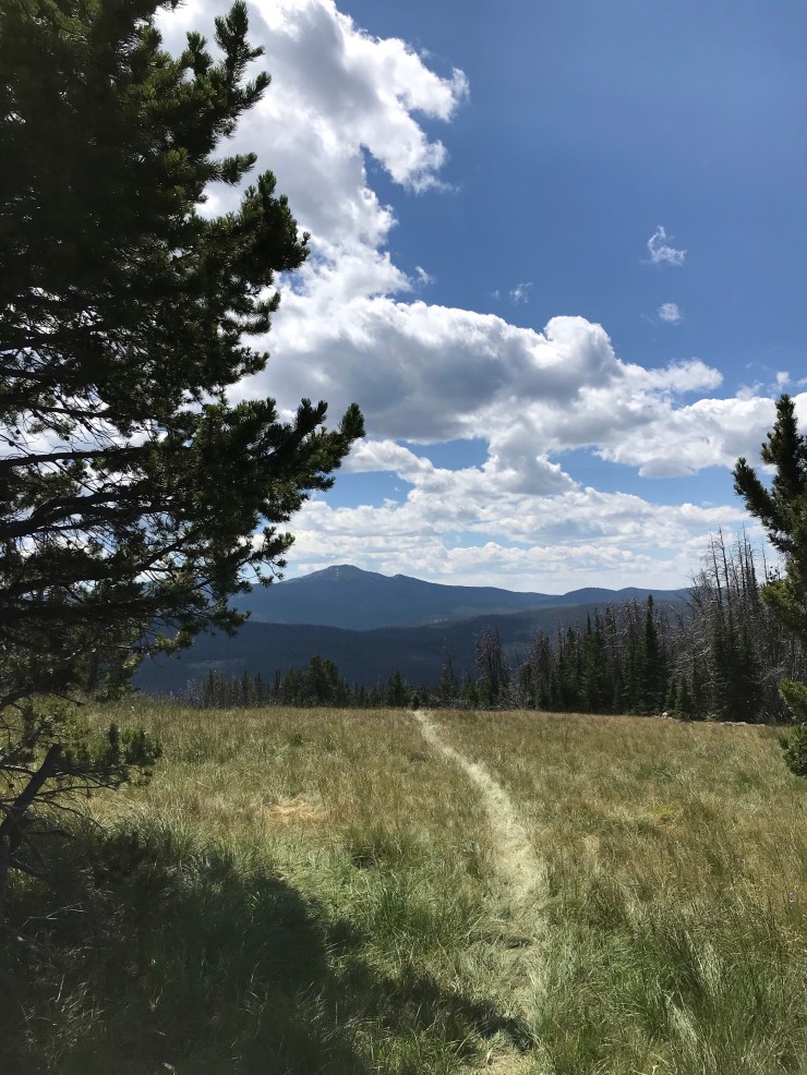
There was another creek crossing and then the climbing really started. According to my watch, mile 7 was 878′ of gain, no loss. The first 15 mile racer passed me somewhere in this section. He flew past on the incline still had the breath to say hi. The climbing continued about halfway into mile 8 where I was stopped by the unbelievable view. These are just a few of the many pictures I took.


There was a little more climbing in this section, and then we came out into the meadow where I was looking for a sharp left turn and then a right turn – the section I had most worried about. I have not yet mentioned how unbelievably well marked this course was. I have never seen so much hot pink duct tape on a course. Even a hiker would not go more than a few minutes without seeing a marker. Seeing the very clear markings in the early miles had reassured me that these random turns in a meadow would not be easily missed. There were two reasons I shouldn’t have worried. First, by now, the 15 milers had caught up and knew the course. Second, there were children standing at the turns, pointing the way. I don’t know which volunteer was able to convince their kids to stand in a meadow on a beautiful Saturday in August, but those kids were great!
After the meadow, we had more climbing and the trail was a little more technical. Then came the downhills – almost 800′ of loss in mile 12 with switchbacks. Just past that was the Teepee Creek aid station. My awesome crew had made the 2 mile hike out with his chair and pack including ice. This was the busiest aid station on the course, serving all three distances. The 15 mile course headed back to the start after Teepee Creek, but the 52k and 50 mile course continued out and then hit Teepee Creek again with just over 2 miles until the finish. The volunteers here were in for a long day. I grabbed chips, some delicious and extremely cold coke, then headed out. Just past the aid station was a creek where the drinks were stored to keep them cold.
The next section was only 4 miles, but was almost all uphill. We wandered along sandy trails through forests, meadows, cows, and switchbacks. These were the slowest miles by far for me. I may have been a little grouchy by the time I got to the Elk Park aid station, but I was really glad to see the volunteers because I knew that meant I was near the highest point on the course. The volunteers had camped at the AS the night before and were wonderfully welcoming and cheerful. They sent us off through the forest full of pine trees occasionally topped with hot pink duct tape. Shortly after hitting the high point just under 8,000′, we entered meadows full of wildflowers with spectacular views.

As we dropped down through the meadows, the trail started to get marshy near another creek. At about mile 19, the course turned onto a forest service road. This section was nice and wide. I caught up with another runner here who had run this race for many years. We were so busy talking, we missed the turn but the wrong way sign set us straight a few feet later. Did I mention how well marked the course is? This is good because the description for this section includes comments such as, “if you take Trail 114 downstream you will go way off course into a vast roadless area, and you may spend at least one night in the mountains.” I had spent so much time focused on mapping the turns and keeping the trail numbers straight that I missed small details in the description for this section like “uphill” and “climb.” I’d thought we were on a nice little trail that allowed the course to shortcut the longer forest road. Mile 22 was nothing but climbing – almost 400′. I commented and my new friend said not to worry, just one more big climb on the way back to Elk Park AS. I pondered that as we entered the AS where 50 milers were on their way back in. The volunteers took good care of everyone and the search and rescue teams were waiting here with dogs in case they were needed. The party atmosphere was impressive considering everyone was in the middle of nowhere.
I left the Tizer Creek aid and headed back up that hill. We were soon heading back downhill and taking the right turn onto trail 114, going around the locked gate as instructed and…climbing. Miles 25 and 26 were over 800′ and only uphill. My head was pounding but I hoped that was just due to the elevation and would go away as I descended. Eventually we crossed another meadow where I dutifully looked left to catch my last view of Elkhorn Peak in the distance and was grateful I did not have to climb it.

The volunteers at Elk Park were as cheerful and welcoming as they had been many hours earlier. I was excited to see them not only for their energy but also because it meant that I was headed back to the finish line down trails I had already seen once. The downhill started as we left the aid station and continued, with switchbacks for a couple of miles. The constant downhill in the sandy soil after a day splashing made it feel like my socks were sandpaper. I finally stopped to change my socks, but it made no difference by then. As the downhill came to an end, we were in a meadow now filled with grazing cows and calves. A woman running the 50 was stopped by a grazing calf on the trail and we weren’t sure how it’s mother would react to us sternly telling it to moooove along but we did and it eventually stepped aside.
The next mile to the final aid station was a gentle downhill and my toes screamed at each other the whole way. We had decided that my patient crew should head back to the finish with plenty of time to spare in case I was close to cutoffs. I was still ahead of my schedule and hoped that he would still be waiting.
I was delighted to see him still there, visiting with the other volunteers. They helped him pack everything up and we headed down the trail together for the last two miles. We compared notes about the day as I tried to speed us along so I could take off my shoes. We crossed the finish line to a surprisingly large crowd still hanging out at the finish line. I was one of the last 50k finishers but the 50 milers were still coming in and had a few hours before the cutoff, so the crowd was waiting to being them in. There was plenty of food, a finisher’s certificate, and a hat for all of the runners. Apparently the RD picks a different thing for finishers every year – I saw others wearing shirts, shorts, and sweatpants from previous years. We stayed for awhile, took a few more pictures, and then packed up for the short drive south to Butte where we stayed that night.
Overall, this was the most scenic and best marked race I’ve done. The 15 hour time limit made the challenging course less daunting and the volunteers were incredibly supportive. My challenge now is finding races as scenic as this one that I can realistically finish – if you’ve run here and know of anything as good as HURL Elkhorn, please let me know. If you haven’t run this race, you should!
Off trail:
That friendly stranger I met on the way to the Mellow Marathon in Michigan who later moved halfway across the country surprised me a couple of months before the race while I was on a training run during the hot Texas summer. He thought I might need some ice and had thoughtfully brought three types for me to choose from. The first was from home, then second was from Sonic (mmmm!), and the third required him to kneel and get out a small box with a ring in it. He offered this third type of ice, I accepted and we celebrated with a popsicle. Then, for an anticlimactic finish, I ran the last two miles that weekend on my training schedule. At least he knows what he’s getting into, right?
tl;dr
- Time limit: 15 hours for the 52k
- Total elevation: 7,875′
- Course type: combination of loops, out and back, but only about 7 miles are repeated
- Trails: singletrack and some forest roads, mostly runnable if you’re one of those fast types, only one small section that was quite rocky
- Aid stations: 6, 2 are repeated. Longest stretch without aid is 8 miles.
- Weather: It was sunny and high 50s at the start, low humidity. Great day for running.
- Parking: plenty at the start line
- Runners: about 150 across all 3 races
- Nearest airport: Bozeman is about 90 minutes from the race start.

I really enjoyed reading your description of the race!
LikeLiked by 1 person